
Route to Southern highway

Austral Route Highway (Route 7)
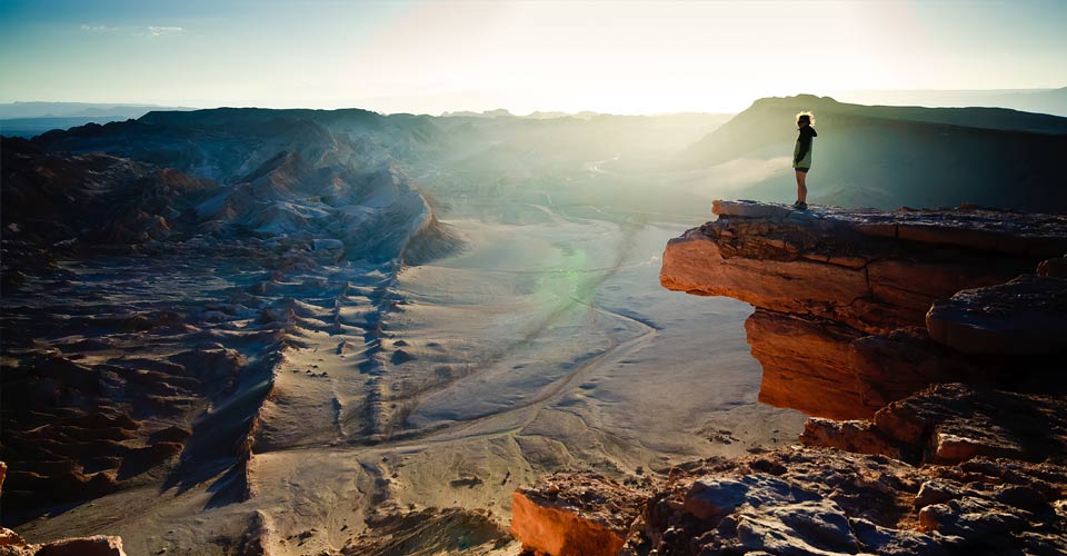
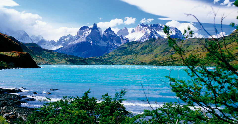
The Carretera Austral (Austral road or Southern Highway) is a trip to beautiful landscapes that are part of the north of the Chilean Patagonia. The trip begins in Puerto Montt and it ends on Villa O'Higgins, both sites are united by 1,240 kms of extraordinary Patagonian beauty.
The route presents some asphalt road sections and others are gravel roads. Some distances must be crossed by ferry, sailing through fjords, lakes and rivers in various types of forests.
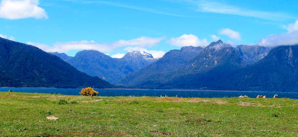
Evergreen forests and Andean Patagonian forests, have impressive views that magnify the power of nature, portrayed in impressive snowdrifts, lakes of multiple colors, fjords and glaciers, vast pampas and many national parks that are possible to find throughout the journey of this unique adventure !
The Austral Road is divided in five sections:
Section 1: Puerto Montt Chaitén
The first part begins in the city of Puerto Montt, from here is up to 205 km to get to the town of Chaitén.
It starts driving on Route 7, 46 km are paved and bordering the coast with beautiful views towards the La Arena town.
Near to the road is the Alerce Andino National Park. This park has 20,000 hectares of larch (Alerce: Native tree), endangered.
From the small cove (caleta, in spanish) of La Arena is necessary to embark on a ferry and sail 30 minutes through the Reloncaví estuary, landing at Caleta Puelche.Then you have returned to the ground road to head further south, where you'll find the Caleta Manzano, Fjord Pichicolo and Hornopirén, place where you take the second transfer and navigate 6 hours to get to the town of Chaiten, a city that is now semiabandoned after a volcanic eruption in 2008, but you may find provisions and basic services in this place.
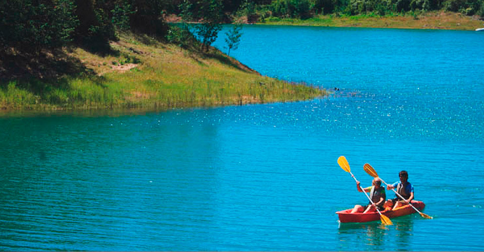
On the Chaiten's surroundings, the Pumalin Park stands out with more than 290,000 hectares, becoming one of the major and most diverse conservation projects in South America. It extends from the Andes to the fjords of the Pacific coast. A majestic landscape of evergreen forests or "Valdivian forests" stands out, and observation of flora and fauna includes sightings of toninas (dolphins), sea lions and even whales. The park has many trails leading to waterfalls, volcanoes and extensive rainforests. It is also possible to practice some activities such as biking, hiking, wildlife watching, and kayaking to explore the fjords of Comao and Reñihue in an amazing experience.
TIPS: Another alternative is to sail from Puerto Montt to Chaiten, with a journey of around 10 to 12 hours, depending on the boat and navigation conditions. www.navieraustral.cl www.navimag.cl
- During high season (December to March) ferries are available. They unite the essential places to complete the journey!
- The ferry that connects the town of La Arena and Puelche operates without reservation. It works in the order of arrival and it costs approximately CLP $ 10,000 . / USD 22. per vehicle and is paid on board.
- Ferries operating from Hornopirén to Leptepú and from Fiordo Largo to Caleta Gonzalo require reservation and prepay.
Section 2: Chaitén – La Junta
The second part of this adventure starts from the town of Chaiten, crossing around 150 km, most of them are gravel. Starting on Route 7 and heading south, you have 25 km that are paved and lead you to the Termas del Amarillo (hot spring). There are camping areas in the surroundings, as well as the Lake Yelcho riviera.
Futaleufú is located near to Chaitén, 25 km south. Futaleufú is one of the most important places in Chile for rafting and kayaking and is recognized worldwide for being one of the best spots for practicing this sport.
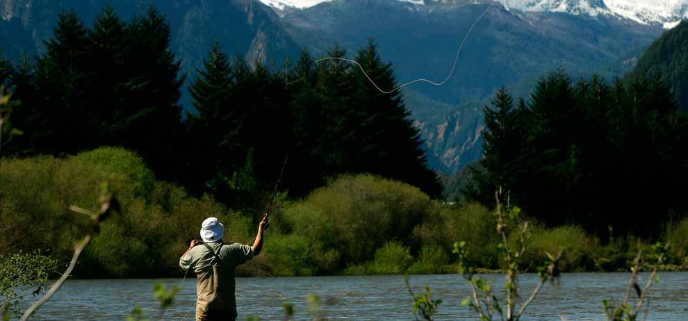
Another interesting place is Lake Yelcho, with an area of 116 km2. It is a beautiful lake of glacial origin and emerald green waters. The lake is surrounded by icecapped mountains, forests and open waters, making it possible to carry out activities such as fly fishing and hiking. The Carretera Austral runs through the northwestern part of the lake, so do not miss it!
Continuing along Route 7 (Austral Highway) towards the south is the town of La Junta, 151 km of Chaitén. It is also known as the people meeting point, as this site converges between the two main rivers: Rosselot and Palena. Besides, several roads diverge from here to different locations; east to Lago Verde; west to Raul Marin Balmaceda and Puyuhuapi to the south.
At the town of La Junta you will find impressive national reserves, such as Palena lake, with beautiful views of the lake and the Rosselot lake.
The Rosselot Lake National Reserve, is located 186 km north of Coyhaique. In the reserve you can go hiking and enjoy seeing different flora species such as coigüe, canelo (cinnamon) and notro. It is also possible to see animal's settlements like puma, condor, eagle, red fox and Pudu, among others. Highly recommended!
Section 3: La Junta Coyhaique
The section starts in La Junta and continues south at a gravel road towards Puyuhuapi. On the trip's highlights there is the Risopatrón Lake, in the northern sector of Angostura, with the Queulat National Park entrance, main attraction of the road. After 45 km is the town of Puyuhuapi, where you can find supplies and basic services.
The town of Puyuhuapi is better known for its architecture, influenced by German settlers. To the west you'll find the famous Termas de Puyuhuapi (hot springs) known for its three springs, surrounded by a beautiful landscape, highly recommendable!
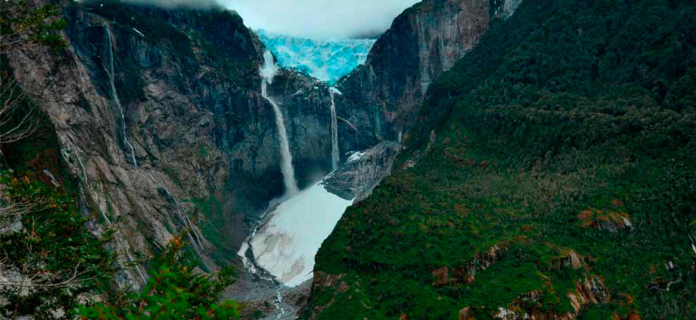
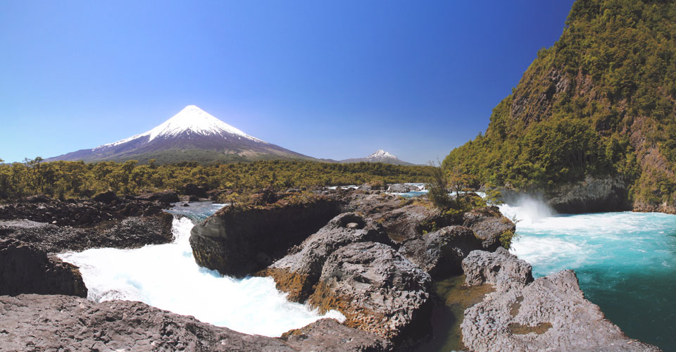
The Queulat National Park is located 165 km north of Coyhaique. It is known for its beautiful Patagonian forests, waterfalls, fjords and rivers, being the most important attraction the Hanging Glacier, one of the typical postcards of the Austral Highway. To visit the glacier you must go south of the park, access is through Valle del Río Ventisquero.
Some species that inhabit the park are condor, chucao, magellanic woodpecker (carpintero negro), pudú, güina and puma.
The tour continues through the Austral highway, highlighting the national reserves of Lago Torres and Mañihuales. You can make a stop in the town of Mañihuales, near the river of the same name, where you can find supplies, use basic services, load fuel and find supermarkets.
About 13 km south, the road splits. An alternative is to continue along the original route of the Austral highway on a gravel road that goes from Villa Ortega to Coyhaique. You will have the opportunity to meet other attractions such as Cerro Mano Negra, Cerro Rosado, Cerro Bayo and river Emperador Guillermo.
The other alternative is to take the detour to the right to the Viviana crossing, from where you can go to the cities of Puerto Aysén and Coyhaique, bordering the Simpson River and the national reserve of the same name.
National Parks: Queulat, Magdalena Island.
National Reserves: Lake Carlota, Lake Las Torres, Mañihuales, Simpson River, Coyhaique, Trapananda.
4 Section: Coyhaique Cochrane

This route is 334 km long and is partially paved. Its surroundings are wild protected areas of great tourist and environmental interest.
From Coyhaique heading south, after traveling 60 km paved, the Cerro Castillo National Reserve welcomes us with open arms.
A few kilometers further south is the village Villa Cerro Castillo, where you can find basic services and tourist information. The peaks of this site are often covered with snow all year; this is one of the aspects that differentiate it from other sites on the Carretera Austral, like its characteristic beech forests and mountains of granite. Other natural attractions of this area are the species of fauna, such as the huemul and the native deer, which are endangered.
Back to the gravel road and bordering the Rio Murta, you should reach the junction located in Puerto Murta, and then you'll have 30 minutes of driving to get to Puerto Río Tranquilo, a place that has basic services, fuel and food.
From Puerto Río Tranquilo you can access some excursions to visit the impressive Nature Sanctuary Marble Chapels (capillas de mármol). These are rock formations that arise as a result of wind erosion and the force of lake General Carrera, which is the second largest in South America. The place stands out for the many rock formations that contrast with the green and blue of the lake's waters.
From this point it is also advisable to follow the path of the Exploradores valley, where you can find excursions to the Campo de Hielo Norte (Northern Ice Field), where you can visit the Laguna San Rafael or Glacier Exploradores.
Continuing along the austral highway is possible to find places of great beauty such as Monte San Valentin, Cerro Arenales and Glacier Valle Leones. 70 km south of Puerto Tranquilo is the Maiten junction, with a path that leads to Chile Chico. Continuing the path is Puerto Bertrand, a town where you can see the lake of the same name and the Baker river, here you can find activities like rafting and fly fishing.
Heading to the south you'll find the capital of Cochrane, as known as the "province of the glaciers". Cochrane is one of the main centers of supplying and services in the south of Coyhaique. Nearby you can visit the National Monument Paso San Carlos and The Tamango National Reserve, where walking activities are offered and are suitable to the open public, with areas intended for conservation and sighting of huemules.
Section 5: Cochrane Villa O'Higgins
From Cochrane to Caleta Tortel is a distance of 128 km on gravel road. This is a route of great beauty, in nearby protected wilderness areas you can see huemules, as well as the lakes Esmeralda, Chacabuco and Vargas, and then go next to the Baker River to its end, where the town of Caleta Tortel is located.
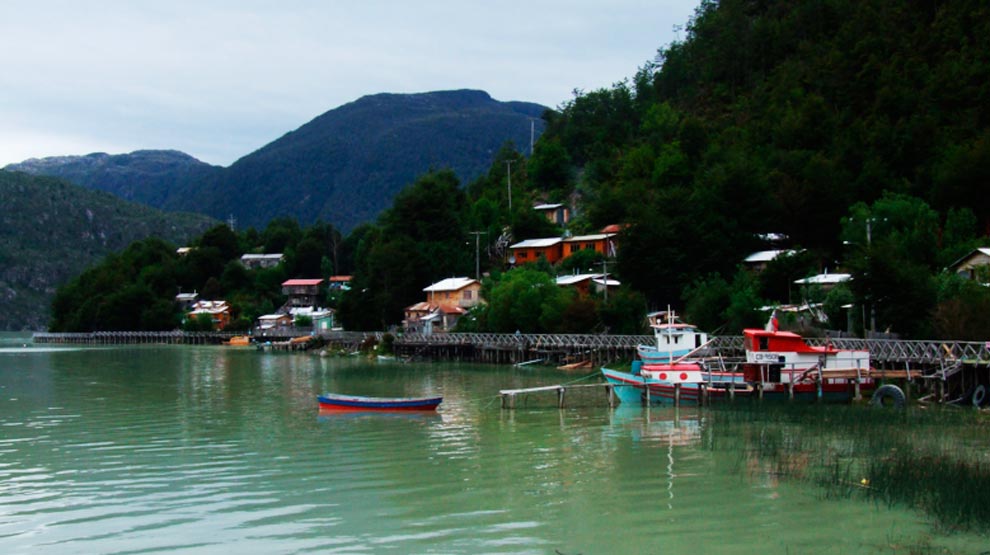
In Caleta Tortel, you can only park the car in the high sector, since the town can only be explored by foot because the streets were transformed into walkways of Guaiteca's cypress (native tree species), and therefore has become typical zone.
To go to Villa O'Higgins from Tortel you should continue towards the Fiordo Michel, where you will find Puerto Yungay. From here you can go into a ferry that is for free and in order of arrival, it takes for about an hour to reach the Rio Bravo's ramp. Then the road continues for 100 kilometers to Villa O'Higgins.
It highlights the path that follows the river Mosco, up to the glacier of the same name.
Bahamondez port is located on the Lake O'Higgins shores. This is one of the largest lakes of the Chilean and Argentinean Patagonia, sharing between 1,013 km2. The O'Higgins lake is fed from melting glaciers located in the Campo de Hielo Sur (Southern Ice Field). And this place is where the adventure along the Austral highway concludes.
TIPS: Before starting the tour is important to know the frequency and operating hours of the ferry and the border crossing, the places of supply, the climate and food services available.